


CHESWICK, Hamilton County, Indiana
About
Outline

Summary
| Unique Area Identifier | 577474 |
| Name | CHESWICK |
| County | Hamilton County |
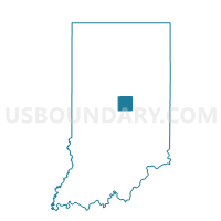
| State | Indiana |
| Area (square miles) | 0.50 |
| Land Area (square miles) | 0.49 |
| Water Area (square miles) | 0.01 |
| % of Land Area | 98.72 |
| % of Water Area | 1.28 |
| Latitude of the Internal Point | 39.98719160 |
| Longtitude of the Internal Point | -86.17400270 |
Maps


Graphs
Select a template below for downloading or customizing gragh for CHESWICK, Hamilton County, Indiana


Neighbors
Neighoring Voting District (by Name) Neighboring Voting District on the Map
- CLAY NORTHWEST 02, Hamilton County, IN
- KINGSBOROUGH, Hamilton County, IN
- SADDLE CREEK, Hamilton County, IN
- SPRING FARMS, Hamilton County, IN
- SPRING MILL PONDS, Hamilton County, IN
- THISTLEWOOD, Hamilton County, IN